Satellites
By Giacomo Ciurlo
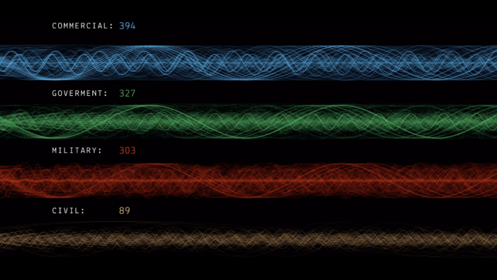
This visualisation maps on different sinusoids the trend of the satellites around the Earth using as the amplitude of the curve the distance of the satellite from the Earth and as the period the speed with which it completes a revolution around the Earth. The satellites have been divided according to their user (civil, government, military, commercial, etc.) and are distinguished by a different colour. The aim is to make you feel the crowding of satellites that we have created around the earth.